


Severe Storms Set to Lash with Rain, Wind and Hail
- admin928749
- Sep 10, 2025
- 2 min read
The Bureau of Meteorology is warning New South Wales residents to brace for a wild day of weather, with thunderstorms, heavy rain and even flash flooding on the cards.
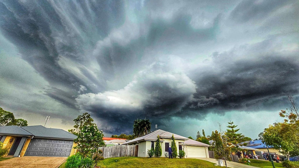
A huge cloud band is sweeping across Australia, pushed along by a low-pressure system and cold front. It’s expected to move from South Australia across to the east coast today and tomorrow.
Some areas could cop a drenching — the Illawarra, northern South Coast and eastern Southern Tablelands are at risk of 60 to 100mm of rain in just six hours from tonight. Over a full day, parts of the coast could see up to 140mm.
The Bureau posted on X (Twitter) this morning, warning that storms could be “extensive” and may turn severe, bringing damaging winds, heavy rain and even large hail.
“It’s a good day to stay up to date,” the Bureau advised.
Right now, severe weather warnings are in place for Lord Howe Island, the Illawarra, parts of the South Coast and the Southern Tablelands, with a minor flood warning active for the Namoi River.
In Sydney, between 15 and 45mm of rain is expected today before easing tonight, but meteorologists are warning of damaging gusts and big coastal waves as the system lingers offshore.
BoM senior meteorologist Miriam Bradbury said moisture and strong winds will be pushed up against the NSW coast.
“It will linger there … potentially leading to further severe weather for areas between the Hunter and the South Coast,” she said.
And it’s not just NSW — over the next couple of days the system will also soak northern Victoria and southern Queensland. Severe thunderstorms are again possible, with the risk of damaging winds and heavy rainfall.
Stay tuned with Aus News Lanka – the leading platform for news for Australians.


Comments